David Rumsey Collection
View high-resolution scans that showcase the breadth of the David Rumsey Map Collection, including atlases, globes, school geographics, maritime charts, pocket maps, wall maps, and manuscript maps.
LOADING
大卫·拉姆西地图收藏中心。历史地图集拥有超过15万幅地图及相关图像,全部在线呈现。该系列包括16至21世纪北美、 南美、 欧洲、亚洲、非洲、澳大利亚、南极洲、 太平洋、 北极以及 世界 其他地区的珍稀地图。 这个在线地图集是一个可搜索的数据库,让您可以探索过往的空间图景。在这里,您可以查阅1500年至21世纪的原始资料,了解制图学的发展历...

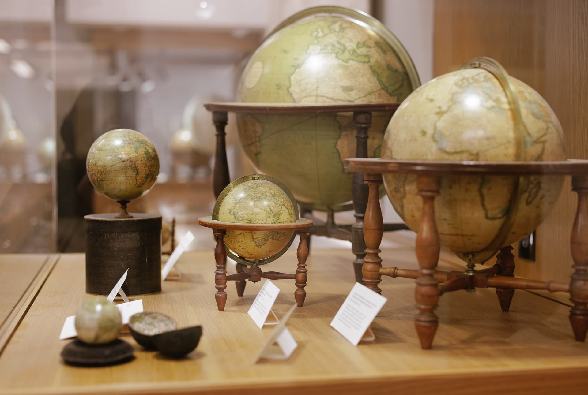
Since its opening in 2016, the David Rumsey Map Center has served as one of the most significant cartographic collections on the West Coast. Sitting at the intersection of technological advancement and historical materials, we house thousands of maps, atlases, and globes, as well as thousands of digital records, making them accessible to researchers across the world on our two wall-sized screens. We foster relationships between the public and these materials through a vigorous program of classroom instruction, researcher consultations, physical and digital exhibits, conferences, talks, and other events.
View high-resolution scans that showcase the breadth of the David Rumsey Map Collection, including atlases, globes, school geographics, maritime charts, pocket maps, wall maps, and manuscript maps.
Stanford University Libraries is home to a strong collection of maps of Africa, including maps donated by Oscar I. Norwich and Caroline Batchelor as well as maps from the Barry Lawrence Ruderman Collection, the University of Cape Town Collections, and the David Rumsey Map Collection.
The first mention of California as an island is in Garci Rodriguez de Montalvo’s novel Las Sergas de Esplandián, published in 1510. It was not until Father Eusebio Kino’s map A Passage by Land to California was published around 200 years later that this cartographic blunder was exposed. Containing nearly 800 maps, materials in this collection range from hemispheric to world maps, from title pages to celestial charts, all depicting California as an island.

 Panorama of Moscow, 1848. Dmitry Stepanovich Indeitsev.

Browse 150,426 Maps and Images
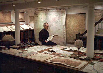 |
David Rumsey amid items of his map, atlas and globe collection |
The David Rumsey Map Collection was started over 35 years ago and contains more than 200,000 maps. The collection focuses on rare 16th through 21st century maps of North and South America, as well as maps of the World, Asia, Africa, Europe, and Oceania. The collection includes atlases, globes, wall maps, school geographies, pocket maps, books of exploration, maritime charts, and a variety of cartographic materials including pocket, wall, children’s, and manuscript maps. Items range in date from around 1550 to the present.
Digitization of the collection began in 1996 and there are now over 150,000 items online, with new additions added regularly. The site is free and open to the public. Here viewers have access not only to high resolution images of maps that are extensively cataloged, but also to a variety of tools that allow users to compare, analyze, and view items in new and experimental ways.
Maps are uniquely suited to high-resolution scanning because of the large amount of detailed information they contain. In their original form, maps and atlases can be large, delicate, and unwieldy. Digitization increases their accessibility, helps to extend longevity by minimizing handling, and when combined with a robust online catalog, maps can be searched in a variety of ways. The site allows public access to rare maps that had been previously available only to a few.
With Luna Imaging’s LUNA software supporting this virtual library, the maps are experienced in a revolutionary way. Multiple maps from different time periods can be viewed side-by-side. High resolution permits the inspection of detail with the same intimacy of viewing the maps in person, using a magnifying glass. Viewers can also create their own collections of maps that hold particular interest by saving groups of images together. Complete cataloging data accompany each image, enabling in-depth searches of the collection.
The collection is distinguished by American cartography illustrating the country’s history, with its changes in culture and population over time. Close inspection of the maps often reveals the growth and decline of towns, mining excavations, the unfolding of the railroads, and the exploration of the American West by European settlers. The depiction of westward expansion also features locations populated by indigenous peoples, including Indian reservations. The collection also includes European maps of the Americas that were influential to American cartographers. In addition, the collection’s geographical coverage spans the globe, with maps of superlative craftsmanship, historical significance, and beauty. Many maps of other parts of the world appear in different languages, such as French, Spanish, Portuguese, Italian, Dutch, Greek, Russian, Arabic, Chinese, Japanese, Vietnamese, and braille. Connecting them all is the universal tongue of visual communication.
A more detailed description of the early evolution of the physical collection into the online collection can be found in “State of the Art”, an article that originally appeared in Mercator’s World Magazine. Here, David Rumsey describes his intention in sharing the maps digitally – “When you can see all the maps, globes, charts, atlases and their related materials in one space, as you can in my physical library, you can start to sense how maps grow one from another in time, as one map incorporates the new discoveries of an earlier map, and thus you can visually feel the flow of history over several centuries … I hope to re-create this sense of connection between the maps and history, as well as introducing people to the stunning beauty of these arcane materials that most have never seen.”
David Rumsey has donated his entire physical map collection to Stanford University where it is housed at the David Rumsey Map Center in the Stanford University Library. The Rumsey Map Center is open to the public Wednesdays & Thursdays from 1-5pm, Fridays from 9:30am-5pm, and weekday mornings by appointment. Stanford also archives all of Rumsey’s digital map collection in the Stanford Digital Repository. Rumsey continues to make his collection available online at www.davidrumsey.com
The collection on the Internet brings together the finest optical equipment and digital scanners, cutting edge viewing technology, the latest image processing software, powerful wavelet compression, and reliable long-term storage of digital images. The digitized maps are very high resolution images scanned at 300 to 800 pixels per inch, as measured against the original map’s dimensions. The larger maps generate files frequently approaching 5 gigabytes in size; the average file size of images in the collection is 250 megabytes.
The following hardware and software is used in the process of creating and distributing the images over the Internet:
Computer Network:
Cartography Associates, founded in 1996, promotes the distribution of digital facsimiles both in print and electronic media. Specializing in both primary source documents and cutting-edge technology, Cartography Associates is committed to developing tools that integrate cataloging with visual images on the Internet. Cartography Associates’ vision is to offer users the best of both worlds: the powerful searching, access, and user functionality made possible by technology, combined with the visual beauty, technical mastery and intellectual richness of original source materials. Currently these individuals contribute to the work of Cartography Associates: Fatemah VanBuren (cataloging), Emily Prince de la Cruz (cataloging), McIntyre Parker (cataloging), Glenn Bachmann (imaging), Sophie Appel (imaging), Brandon Rumsey (imaging), Nate Kallick (imaging) and David Rumsey (cataloging and imaging). Past contributors have been Julie Sweetkind-Singer, Kristian McManus, Phil Hoehn*, and Daniel Holmes.*
*Daniel Holmes died September 30 2021. His contributions to our work were profound, over many years, and we will miss him.
*Phil Hoehn died February 6, 2023. Phil was an extraordinary map cataloger who added hugely to our work as well.
Images from this web site and database may be reproduced or transmitted, but not for commercial use. Permitted non-commercial use is any work or publication, either in print or digital media. Please give image credit to “David Rumsey Map Collection, David Rumsey Map Center, Stanford Libraries” Commercial use is selling reproductions of our images. For commercial use or commercial republication, contact mailto:[email protected]
This work is licensed under a Creative Commons License. By downloading any images from this site, you agree to the terms of that license. Users are expected to abide by all copyright laws. Distribution, reproduction, or other use requires the written permission of any copyright and other rights holders unless the materials are in the public domain or authorized by fair use or other statutory exemption. It is the user’s obligation to determine and satisfy copyright or other use restrictions when publishing or otherwise distributing materials found in this collection. For maps not in the public domain that we know are being sold by their makers, we do not allow downloading or printing and we attempt to provide a link to the maker’s site in our metadata for the map.
本站安逸导航提供的斯坦福大学 大卫·兰姆齐地图中心 数字馆藏都来源于网络,不保证外部链接的准确性和完整性,同时,对于该外部链接的指向,不由安逸导航实际控制,在08/25/2026 14:49收录时,该网页上的内容,都属于合规合法,后期网页的内容如出现违规,可以直接联系网站管理员进行删除,安逸导航不承担任何责任。